
 By Jay Grymes & Steve Caparotta
WAFB First Alert Quickcast:
- warm, mostly-dry for Tuesday- scattered light rains for Wednesday
- a real chill arrives later in the week
It was a mighty fine weekend weatherwise, although Tigers and Saints fans aren’t happy at all about the weekend turn of events. At least the Jaguar Nation had something to cheer about!
Today stayed the course with our dry autumn weather, with a cool morning start and a mild afternoon under sunny skies. However, we are headed into a run of rapid weather chances that began this afternoon and will extended through the weekend.
Flow off the Gulf has become well established and that means a warmer night and morning start for Tuesday, with patchy fog to begin Veterans Day. Although most memorial services tomorrow should be okay, we can’t rule out an afternoon or evening shower or two -- set Tuesday afternoon rain chances at less than 20% under mostly-cloudy skies. What you will notice on Veterans Day is that the afternoon gets rather warm with many WAFB neighborhoods seeing highs near 80° or more.
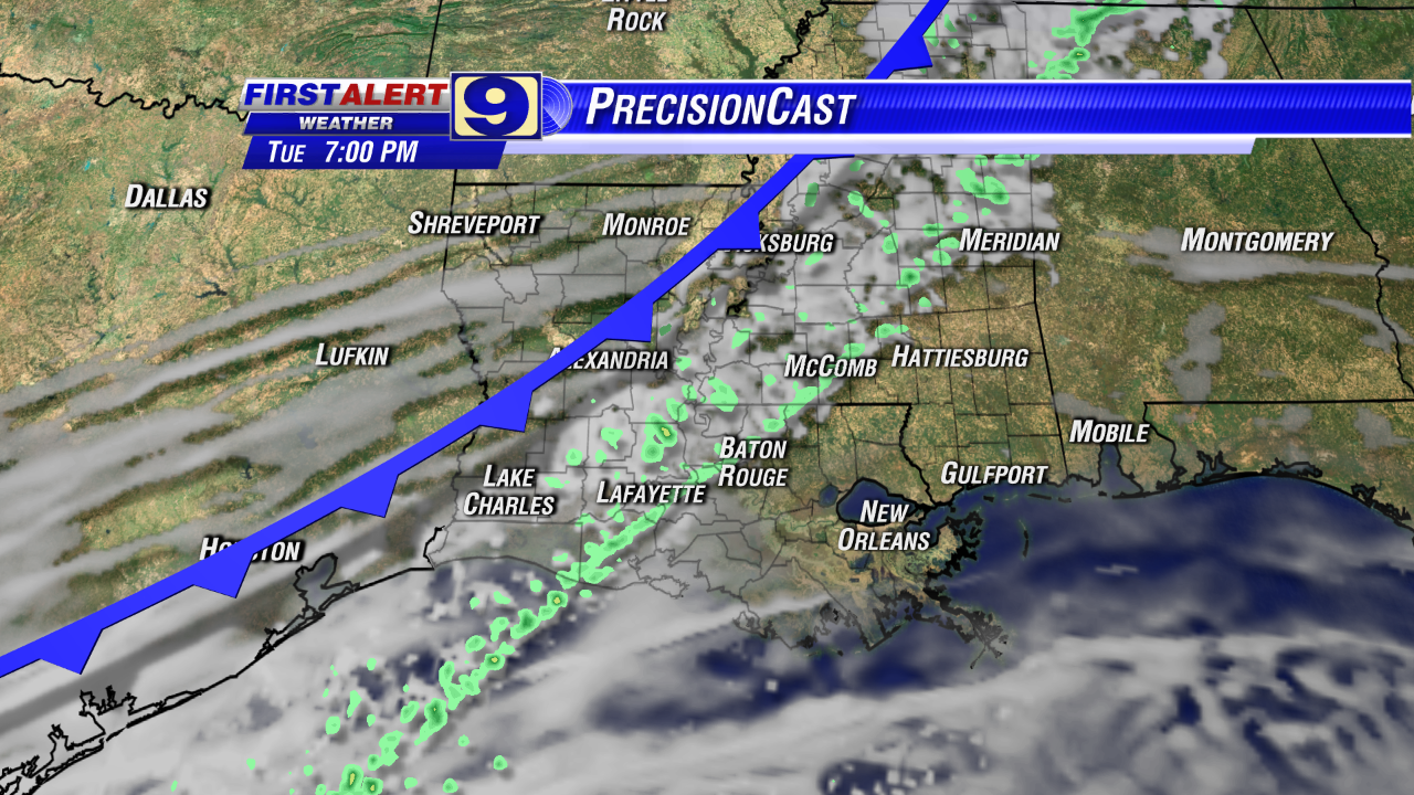
Rain chances increase somewhat for Tuesday night into Wednesday, but most of you will be disappointed: even if you get some rain, it certainly won’t be the ‘soaker’ you’d like. Occasional light showers on Wednesday could produce less than 0.1” for most of us with some WAFB communities not getting enough to measure in the raingage. What you will also notice, however, is a big change in temperatures, with Wednesday’s high coming in about 20° (or more) lower than Tuesday’s high. With the clouds and occasional showers, Wednesday is shaping up to be a rather disagreeable day: cool and dampish, even though rain chances through the course of the day will be only about 30% or so.
By Thursday, the chill really begins to arrive. Thursday morning begins with lows in the upper 30°s to low 40°s for most WAFB areas, with daytime highs struggling to make it into the mid 50°s for the Red Stick under partly cloudy skies. And by Friday’s sunrise, about half of the viewing area could be near or below freezing!
If Baton Rouge hits freezing on Friday morning, that would be early for the metro area. Uncommon but certainly not rare: a look back in the record books shows that Baton Rouge has reached 32° (or below) by or before mid-November on about 1-in-4 years, on average. As a matter of fact, BTR’s first 32° last fall arrived on November 13th (and, if you remember, temps dropped into the 20°s for the last three days of the month – now THAT was unusual).
However, as we’ve mentioned in the past, the “average date” of the first fall freeze for Baton Rouge arrives around the last week of November. The statistical date in on or about November 27th based on data since 1981. However, for the trivia lovers, that date does move ahead by a few days (earlier in the month) if we choose to include more pre-1981 years. For an easy, rule-of-thumb reference, we can use Thanksgiving Weekend as a rough guide to the timing of the “average” first freeze for the Capital City region. (Of course, the date is earlier for locations north and east of Baton Rouge, and later as you head to the south of BTR.)
After the cold start, highs on Friday remain in the 50°s although it should be a mainly sunny day. Then most of us return to a high near 60° for Saturday with the coldest part of the northern air mass missing the Gulf Coast this go-around (Note to media: STOP! With the ‘Polar Vortex’ noise, please!).

Our next front is currently scheduled to arrive on Sunday, and the early signs are that Sunday’s front delivers a decent rain. Let’s hope so!
All quiet in the tropics …
No comments:
Post a Comment