Thursday, April 30, 2015

Staying Nice into the First Days of May

By Jay Grymes & Steve Caparotta

April 30 First Alert Quickcast:

- nice weather extends through the weekend
- only isolated rains early next week

It’s been a beauty of a day to close out April, and there is more of this great weather on the way for Friday and the weekend!  Take advantage if you can, because the summer heat and humidity will be here before you know it.

We will close the book today on a “warm-and-wet” month of April.  April’s monthly temperature of 71.4° (preliminary estimate) for Baton Rouge was more than 3° above the norm.  While that may not sound like a big departure, April 2015 ranks among the 15 “warmest” Aprils for metro Baton Rouge based on records back through 1893 (123 years).

And wet?  You bet!  Baton Rouge’s Metro Airport (BTR) April rain total of 8.08” was nearly double the April norm, making this April the “wettest” April since 1997 and ranking among the top 20% for all April rain totals for metro BR.  But when you look around the viewing area, BTR’s April total pales in comparison to some other locations.  10” to 12” monthly totals are commonplace for places south of the Capital City, with raingage sites like Gramercy (14.70”), Donaldsonville (14.10”), Morgan City (14.42”) and Franklin (15.49”) reporting roughly three-times their respective April normal rainfall.


Given the wet month, our current run of sunny, low humidity days is doubly welcome.  And the great weather we’ve enjoyed for the last two days of April will continue into the first days of May.  We’re going with mostly-sunny to sunny skies for Friday, Saturday and Sunday ... so go ahead and make plans to get outside over the next few days!

We’re expecting a morning low on Friday in the mid to upper 50°s for metro BR.  During the day, a dry, reinforcing cool front will slide through the viewing area.  Although highs will return to around 80° or so for the Red Stick, the front will deliver a secondary surge of continental air, which means a drop in humidity as we end Friday and head into the weekend.  At best, we can expect a few fair-weather clouds for Friday -- in the meantime, it looks just about perfect for Friday’s downtown ‘Live After Five.’


The dip in humidity will mean sunrise temperatures in the low to mid 50°s for both Saturday and Sunday mornings.  Then afternoon sunshine will take Red Stick neighborhoods up to around 80° or so for both days but it stays quite comfortable thanks to the low dew point temperatures.


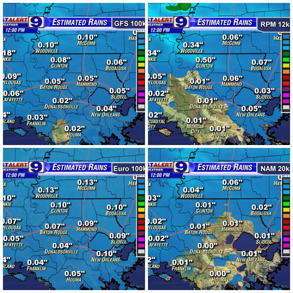
Heading into next week, with high pressure to our east, we’ll start to see a return of Gulf humidity.  For now, we’re posting a 20% chance of afternoon showers for Monday with spotty showers possible for Tuesday and Wednesday afternoons -- so yes, a few showers in the region but most stay dry each day.  With afternoon highs rising into the mid 80°s by mid-week and a continued climb in dew points, we’ll call for scattered afternoon showers for Thursday.

Wednesday, April 29, 2015

Great Weather Continues!

By Jay Grymes & Steve Caparotta

April 29th First Alert Quickcast:

- cool mornings, mild afternoons continue into the weekend!

Morning skies were much clearer than we expected and partly cloudy skies made for a nice Wednesday.  While it was breezy at times, the low humidity was a treat.  Meanwhile, the after-storm clean-up continues and the lights keep coming back on!

Now it’s PAYOFF time in the weather department!  We’re anticipating a run of fine spring days that will carry us through the upcoming weekend. 

Drier (less humid) continental air from the north will keep temperatures on the cool side of normal through the weekend with morning lows in the 50°s and afternoon highs in the upper 70°s to low 80°s.  Along with that will come plenty of sunshine right into Sunday afternoon.

The pattern over the coming days will support a much-needed dry-out for the region too.  Just about the entire WAFB viewing area has received above-normal rainfall this month, with Doppler radar estimates showing widespread estimated rain totals in excess of 10” for April: totals that are two to three times the April norm.  Fortunately, the rains have been somewhat spread-out over the course of the past four weeks: river and bayou flooding has not been a serious concern, although standing water and property flooding has been all too common.

So the dry weather is a double bonus, allowing for easier clean-up efforts and cooperating for repair crews across the region.  And the cooler weather has been a plus for those without power over the past two days too.


Headed into next week, we’ll begin to see a return of Gulf moisture accompanied by an uptick in temperatures and humidity.  Based upon our current guidance, we could see some spotty rains popping up on Doppler radar as soon as Monday afternoon, but most of us can expect to stay dry into Tuesday or possibly even mid-week.

So, put away the umbrella away -- maybe grab the sunscreen -- and make plans for what should be a gorgeous weekend!

Tuesday, April 28, 2015

Much Nicer Days Ahead!

By Jay Grymes & Steve Caparotta


April 28th WAFB First Alert Quickcast:

- dry-out begins tonight and extends through the weekend
- cool mornings, mild afternoons this week

We’ve been tracking spotty showers this afternoon as cooler-and-drier air settles over the region. What light showers and sprinkles that try to persist into the late afternoon and early evening should dissipate quickly.

In the meantime, the National Weather Service has several storm-survey crews out examining some of the damage from yesterday. Thus far, there is a confirmed tornado in the Kenner area and earlier this afternoon one of the NWS survey teams delivered confirmation of a touchdown near Pierre Part and a secondary brief touchdown near Napoleonville. It is likely that these two touchdowns are from the same tornadic storm, although not necessarily from the same funnel/twister. The survey will continue towards Thibodaux -- where law enforcement reported a touchdown -- and then farther east to near Des Allemands. All of this survey is linked to the same system that prompted a Tornado Warning across those parishes on Monday morning.


Another crew has been looking through portions of EBR Parish along the path of a Warned area that extended through metro Baton Rouge: preliminary conclusions from that survey indicates straight-line winds as the culprit.

For the rest of us, the clean-up -- and in some cases, power restoration -- continues. Clouds will linger with us through the night and into Wednesday as we wait for the large upper-level low currently over the Red River Valley (TX/OK line) to make its exit to the east. As long as that upper low remains to our northwest and north, we can expect clouds to persist. That is why we’re anticipating a mix of sun and clouds through much of Wednesday with clearing into Wednesday evening and overnight.

We’ve got lows dropping into the low to mid 50°s for Wednesday’s sunrise; the sun/cloud mix and dry, continental air mass from the northwest will hold afternoon highs down in the low to mid 70°s for the Capital City. But into the night into early Thursday, the last of the clouds should move out of the area. 

Thursday morning will start a nice run of fine spring days with plenty of sunshine. The cooler air mass and clear skies will mean morning lows n the low 50°s for metro BR, with some of WAFB’s northern communities to dipping into the upper 40°s for Thursday’s start!

Mainly-clear skies will persist into the weekend, with BR metro area lows in the 50°s and afternoon highs in the upper 70°s and low 80°s right through Sunday.


So put the umbrella away: our extended outlook keeps us dry at least into the early part of next week.

Thursday, April 23, 2015

'Mixed Bag' of Weather over the Next Three Days

April 23rd First Alert Quickcast:
- showers & storms return on Friday & Saturday
- a very warm but mainly-dry Sunday ahead

The outlook for today was much wetter -- and stormier -- than what materialized.  Rain coverage was rather limited, although we did have a few sites that recorded 0.5” to 1.0” or more for the day.  An eastbound series of showers and storms rolled across the viewing area during the early afternoon, but that was about it for the day.  Isolated showers popped up here and there through the remainder of the afternoon, but there were no severe storms, and no reports of thunderstorm-related winds or hail.

Everything should quiet down into the evening and overnight.  Plan for partly to mostly cloudy skies for Friday’s start, with morning lows in the upper 60°s to near 70° for the Red Stick and some pockets of fog thanks to the muggy, moist air mass.  As with today, our prior forecasts were a bit more ominous for Friday than what we’re seeing now.  We’ll go with Friday afternoon rain chances at 40% with a high in the mid 80°s for the Capital City.


So Friday isn’t a “dry” day.  In fact, the NWS Storm Prediction Center (SPC) says that the WAFB region has a “Slight Risk” for severe storms during the afternoon.  But that is still a better outlook for tomorrow than what I had been thinking … and with a little luck, Baton Rouge gets in a Live After Five for good measure!


Saturday’s weather is a little less clear.  For now, I’m going with a 50% to 60% rain chance for the day, with the chances for rain greatest during the first half of the day.  Again the SPC includes the entire viewing area under a “Slight Risk” for severe storms for the first part of the day.

So it's essentially a 24-hour period with a significant rain potential for the area.  Four of our routine rain-estimating models show a fairly large range of possible totals for the WAFB area -- from under 0.2" to more than 1.0" -- with a good middle range estimate of 0.5" to 0.8" for the period.


Sunday looks pretty good, although it will be quite warm.  Some WAFB neighborhoods could be flirting with highs at or near 90° for the afternoon, and while I can’t say “no rain,” it currently looks mainly-dry through the day.  I’ll go “spotty rains at best” for Sunday afternoon.


 Heading into early next week, a storm system brings rains back for Monday and Tuesday, with the extended outlook showing a clearing by mid-week.

Friday, April 17, 2015

Looks Wet Again for Saturday

April 17th Quickcast: 
- rains likely for Saturday morning 
- Flash Flood Watch extended through Saturday evening 
 
Believe it or not, I have had one person today tell me that they have not had enough rain this week and would like more. 
 
For the rest of us, today’s dry spell was greatly appreciated.  Not only did we see some welcomed sunshine, but the lack of rain almost everywhere allowed areas dealing with standing water to drain.  In addition, the lack of rain was helpful along our area rivers.  While the lower Tangipahoa River is experiencing some minor flood issues, it currently appears that no other local river gaging sites (except those on the Mississippi) will reach flood with this run of wet days.
 
However, that does not mean that we are done with the rain just yet.  While this evening will remain mainly-dry (I can’t rule out a spotty shower or two), most of us will be dealing with another round of rains by Saturday morning.  A large disturbance currently over central Texas -- where it has prompted Watches and Warnings -- is headed our way and should begin impacting the WAFB area in the early morning hours.  We’re expecting showers and t-storms as the stormy weather tracks from west-to-east across our region with the rains potentially extending into mid-day and the early afternoon.
 
Here is the satellite/radar composite as of 8:00pm Friday:
 
 
The threat of additional rain is enough to prompt the NWS to continue the Flash Flood Watch (FFW) into Saturday evening for all of south Louisiana.  In addition, as of this afternoon, the NWS has expanded the FFW to now include all areas across the Florida Parishes north of the I-12 corridor: up until today, those areas and our SW Mississippi viewers were not included in the FFW.
 
According to the NWS Storm Prediction Center (SPC), there will be a “Slight Risk” for severe weather on Saturday, mainly in the form of high winds and hail.  Although unlikely, tornadic storms cannot be ruled out, especially during the first half of the day.  While most of us will see 1" of rain or less, isolated totals of 2” or more will be possible.
 
Set Saturday’s rain chances at 80% for the entire day, although the most widespread action looks to occur during the morning and mid-day.  (With some luck, we could get a break from the rains by the mid to late afternoon hours.)  We’ll start the day in the upper 60°s around the Red Stick, with the daytime high topping out in the upper 70°s.
 
Here are the RPM PrecisionCast and the Hi-Resolution Rapid Refresh (HRRR) radar depictions estimated for 8:00am Saturday as of 8:00pm Friday:


For Sunday, we’ll back the rain chances down to the 30% to 50% range, although the SPC is still maintaining a “Slight Risk” for severe weather given the moist-and-unstable Gulf air that will remain in place.
 
But then finally, some good news for all of us … well, good news for all except for those that really think that they need more rain.  A spring cold front should push through the lower Mississippi Valley early Monday.  That front should sweep the humid Gulf air out of the area, at least for a few days, and mark the onset of a run of drier weather. 
 
For now, we’ll keep things dry through Wednesday, with scattered rains returning for the end of the work week.


Thursday, April 16, 2015

Can't Get a Break from the Wet Spell!

April 16th First Alert Quickcast:
- showers & t-storms likely on Friday & Saturday
- Flash Flood Watch continues
 
 
Well, let’s start with the good news of the day: most WAFB communities stayed dry into the afternoon and as of 3PM there were no Warnings issued anywhere in the region and no reports of storm-related damage.
 
Unfortunately, the rain started moving into the western half of the viewing area -- including metro Baton Rouge -- just in time to add to the trials of our typical evening commute.  Those drive-home rains were accompanied by a few rumbles of thunder in some spots but thankfully no severe storms.
 
 
The Flash Flood Watch continues for much of the WAFB viewing area through Friday at 7:00pm.  At the same time, a Flash Flood Watch has been issued for communities on the west side of the Atchafalaya Basin through 1:00pm Friday … and I suspect that we may see that Watch extended later in the day too.  In fact, I’m really expecting both Watches to be extended into Saturday.
 
The rain should subside a bit later into the evening and overnight, but we’ll keep isolated-to-scattered rains in the overnight and early-morning forecast.  Expect a Friday morning low in the mid to upper 60°s for the Red Stick, with patchy fog for the morning drive too.
 
 
Unfortunately, Friday and Saturday are currently shaping up to be even wetter than today -- we’re going with rain likely for both days with those percentages running at 70% to 80%.  And with those higher rain chances will also come a slight increase in a severe-weather threat, especially for Saturday.  The main threats from severe storms will be damaging winds, but as we saw yesterday, large hail is in the severe weather mix too.  Although the chances are very low, we cannot completely rule out a tornado touchdown in the region either.
 
So when does this extended run of wet weather end? 
 
For the time being, I’m still carrying a 50-50 chance of rain for Sunday.  The real question here is about how long does it take for an upper-level “closed low” currently over the Rockies to move off to the east.  The current thinking is that the upper low remains a factor for our weather through Sunday, pushing a cold front through the lower Mississippi Valley early Monday.  Were that low to start moving east sooner, we might be able to salvage Sunday.


However, the way it looks now, we’ll have to wait until Monday afternoon for some rain relief!


In the meantime, we could see another 2” to 4” of rain -- with some locally-higher totals -- between now and Sunday.  That virtually guarantees more nuisance flooding and standing water ... and will require that we watch our area rivers closely through the weekend.

Tuesday, April 14, 2015

Flash Flood Watch Extended Through Wednesday

By Jay Grymes & Steve Caparotta

April 15th First Alert Quickcast:

- Flash Flood Watch extended into Wednesday for much of the WAFB viewing area
- a bit of a break in the rains tonight
- NWS forecast still suggesting another 3” to 6” of rain between now and the weekend!

What a mess!  The rains got into the viewing area sooner this morning than we expected and they came with a vengeance -- prompting one of the most widespread arrays of Flash Flood and Areal Flood Warnings that we’ve seen in a long, long time.  Thankfully, as we ease into the late afternoon and evening, those Warnings have been allowed to expire.

Radar estimates are showing an extensive area of more than 3.0” of rain for today - - focused across WAFB communities to the south of metro Baton Rouge.  Those big rain totals are highlighted by a bull’s-eye of roughly 5.0” to 6.0” or more along and near the Iberville/Ascension parish line. 


Thanks to our viewers, we’ve received numerous photos of street flooding throughout the WAFB viewing area with reports of water in homes in some locations south of the Baton Rouge metro area.  Those living along and north of the I-10/12 corridor have been far more fortunate today, with radar showing most of these areas with roughly 1.0” to 1.5” for the day.

Thankfully, we should get a break from the heavy rains over the next 18-24 hours.  We’re going with isolated showers for most of the viewing area overnight and scattered rains for Wednesday.  Rain totals for just about everyone should be less than one inch for Wednesday, with many coming in at well under one-half-inch for the day.

Unfortunately, our Thursday and Friday outlooks return to a “rain likely forecast” ... and it doesn’t get a whole lot better for the weekend either.  Our two main extended-range forecast models -- the American ‘GFS’ and the European ‘ECMWF’ -- are both indicating that the much of our area could see another 3.0” to 5.0” of rain between tonight and Sunday evening, with isolated higher totals.

Now ... let’s factor in the radar estimates and raingage reports since last Friday.  They show as much as 6.0” to 8.0” has fallen across portions of WAFB’s southern parish zones already with some radar bull’s eyes topping an estimated ten inches of rain in the Iberville/Ascension area.  Add in the forecast for the coming five days and we could be dealing with some serious high-water problems, especially for areas already pounded by heavy rains over the past five days.


We’ll keep an eye on the Florida Parish rivers too.  So far, with the heaviest rains to the south, we don’t anticipate any serious river flooding -- for the Amite, Comite, Tickfaw and Tangipahoa -- even with the “wet” five-day forecast.   Rains have generally been under two inches across the upper parts of these river basins, thus far.  However, one or more of these rivers could climb out of its banks should the forecasted rains come in one big dousing.

Monday, April 13, 2015

Flash Flood Watch into Tuesday

By Jay Grymes & Steve Caparotta

April 13th WAFB First Alert Quickcast:

- FLASH FLOOD WATCH remains in effect for much of the WAFB viewing area
- “wet” pattern persists just about all week

The NWS tweaked the coverage of the FLASH FLOOD WATCH early this morning, adding several of WAFB’s parishes to the mix early this morning.  The WATCH currently remains in effect for the majority of the viewing area through Tuesday evening, and we would not be surprised to see the WATCH extended into the week given our “rain likely” forecast for Tuesday, Wednesday and Thursday.


Today was a veritable “Tale of Two Cities” in terms of our weather: a wet and gloomy start to Monday but some sunshine and even a soft breeze for the afternoon to make up for the morning.  Unfortunately, the good stuff doesn’t last long …

Clouds will be on the return overnight with spotty to isolated showers likely for Tuesday’s morning commute.  But fog may even be a bigger player for the morning drive, at least in some locations.  We’ll start the day in the upper 60°s to near 70° for the Capital City.  Tuesday’s highs will top-out in the upper 70°s for many of us as a cloudy and wet day takes shape -- we’re going with rain chances at 80% for Tuesday.  While it may not be an all-day rain, the current set-up looks very wet through the middle of the day with the rains settling down by the evening.

Sadly, “wet” is the operative word over the next several days, at least. We're posting rain chances at 70% for Wednesday and Thursday and still at 50% to 60% for Friday.  Even the weekend outlook currently includes scattered showers and t-storms for both days.  Our temperature forecasts through the week call for highs in the upper 70°s to low 80°s with morning minimums in the 60°s -- that means daily average temperatures near- to above-normal each day.


That run of rainy days also means a threat of nuisance flooding and may even cause some issues on local bayous and rivers.  Two of our popular long-range forecast tools -- the American GFS and the European models -- are indicating widespread rain totals of 4” to 5” or more between now and next Sunday evening.


For the time being, we are not too concerned about a severe weather threat over the coming days, but even that will need close watching as waves of rain move through the region this week.

Friday, April 10, 2015

More Rain This Weekend

By Jay Grymes & Steve Caparotta


April 10th WAFB First Alert Quickcast:

- scattered rains into the evening
- more rain this weekend

The rains arrived in the afternoon as expected, washing-out hopes for “Live After Five” and making for an added headache for the Friday evening drive home. The weather turned a bit active in the Baton Rouge metro area a little after 1:00pm with a Severe T-Storm Warning posted for an area east of downtown Baton Rouge. Fortunately, however, the action subsided a bit into the later afternoon hours but we are still keenly watching another wave of rains heading this way from the southwestern parishes.

The cold front responsible for this afternoon’s weather will slide south of metro Baton Rouge this evening but then stall near/along the coast overnight and into Saturday morning. We’ll feel the wind shift and see temps drop into the low to mid 60°s across much of the WAFB viewing area. However, with the front in close proximity through the night, we will keep isolated showers in the overnight and early morning forecast for most of the WAFB area, with scattered rains possible along the coast.

So for many of us, Saturday will start out without rain. There may be some pockets of fog, especially near waterbodies and in those usual suspect spots, but we think that the air will be a little too dry for widespread fog issues -- with the possible exception of the coastal margins. But through the day, the front will begin a northward retreat as a warm front, allowing a return of moist-and-unstable Gulf air into the area and resulting in a return of scattered-to-likely showers and t-storms by the afternoon and early evening.

And for the time being, we’re keeping rain chances in the “scattered-to-likely” categories for Sunday too -- all in all, a relatively wet weekend outlook. We’ve got highs for Saturday and Sunday running around 80° to the low 80°s for both days.

Look for two-day rain totals over the weekend on the order of about 1” on average for the area, with locally higher and lower totals. We’re not particularly concerned about a severe weather outbreak on either day, although we can’t rule out one or two warnings over the weekend given the nature of the unstable air that will be in place.

The outlook for next week doesn’t seem to get much drier either. Our extended guidance is showing a series of passing disturbances through the week including two frontal passages: one around mid-week and another closer to the end of the work week. That all adds up to a continued “unsettled” weather pattern that keeps things damp-to-wet into Friday.


Not everyone gets rain every day, but over the course of the next seven days we could easily see widespread rain totals of 3” to 4” with locally-higher totals based on the current extended-range guidance from the NWS Weather Prediction Center.

So stay dry .. get outside when you can .. and enjoy the weekend!

Wednesday, April 8, 2015

Better Rain Chances Ahead

By Jay Grymes & Steve Caparotta


April 8th First Alert Quickcast:

- isolated afternoon showers for Thursday
- showers & t-storms for Friday afternoon and evening
- scattered-to-likely rains for Saturday & Sunday

A very warm afternoon for the viewing area under partly cloudy skies -- in fact, Baton Rouge Metro Airport’s high of 87° today ties the all-time record for this date, a record that has stood since 1907 -- 108 years.


We did see a few specks of rain on regional Doppler radar during the afternoon but what did bubble-up in the afternoon died-out quickly ... and we’ll stay with partly cloudy skies through the evening and into the overnight hours. By Thursday’s sun-up, expect partly-to-mostly cloudy skies with some patchy fog with low temperatures in the upper 60°s to near 70°. We’re expecting a little more wind in the morning, and that should keep us from the widespread dense fog that many encountered during the past couple of mornings.

For Thursday afternoon, we’re calling for a sun/cloud mix with rain chances at around 20% or so and highs again in the mid to upper 80°s for the metro area. Then into Thursday night through early Friday it will be another round of partly-to-mostly cloudy with some patchy wake-up fog.

Unfortunately, the Friday afternoon and evening forecast hasn’t improved. We’re still anticipating the arrival of a cold front during the latter half of the day, bringing showers and t-storms to the area -- complete with a “Slight Risk” for severe storms. That’s NOT what “Live After Five” fans want to hear. 

And there’s not a lot of good news for the weekend either. Friday’s cold front is expected to stall near the coast, then begin a retreat to the north as a warm front on Saturday. With that, we’re staying with “rain likely” for Saturday. What’s more, we’ve got scattered showers and t-storms for Sunday too. The only bright spot in this wet forecast is that neither Saturday nor Sunday shape-up to be all-day rains … but you’ll need to keep an eye on the live radar on your WAFB Weather App and schedule your outside time accordingly.


Into next week, we’ll still carry scattered rains in the forecast for Monday, Tuesday and Wednesday.

Tuesday, April 7, 2015

Mainly Dry Again for Wednesday

By Jay Grymes & Steve Caparotta


April 7th First Alert Quickcast:

- areas of fog return for Wednesday morning
- mainly dry for Wednesday
- rain likely for Friday & the weekend

We started the day with areas of fog, with a Dense Fog Advisory in effect during the morning for a number of parishes. The fog and low clouds were somewhat slow to clear through the morning, but by the afternoon we had shifted to partly cloudy skies with highs in the 80°s with very little showing up on Doppler radar.

Our Wednesday forecast calls for a near repeat of Tuesday’s weather: areas of fog for the morning, becoming dense in some areas and potentially prompting another round of Advisories. Then it’s back to the mid to upper 80°s for Wednesday afternoon with spotty showers, at best. 

You’ve probably noticed a bit of a muggy feel to the air. Our dew point temperatures have been running in the mid and upper 60°s since Tuesday and are likely to stay there for the next few days as flow off the Gulf has added low-level moisture to the air. While dew points in the 60°s may not be truly “summerlike,” they are well above normal for early April -- average dew points at this time of year are in the mid to upper 50°s.

For Thursday, we’ll up the rain chances to 20% to 30% for the afternoon, so most WAFB neighborhoods remain dry as highs again return to the mid 80°s. But after that, our guidance is pointing to a run of “wet” days extending from Friday right into next week.

A cold front arrives on Friday, with showers and t-storms likely by the afternoon. It’s still early, but we’ll want to keep watch for the potential for a few strong to severe storms on Friday too.


Unfortunately, rather than simply sweep through the region and leave us with a cooler and less-humid weekend, our guidance is suggesting that the front slows, stalls and then retreats to the north as a warm front: that’s a recipe for a wet Saturday and Sunday.

To add to the wet forecast, the meandering front will get some added help from eastbound disturbances. Of the three days, Friday appears to be the most active in terms of storms but most WAFB communities are likely to deal with showers and a few storms for all three days. For the time being, Saturday and Sunday don’t appear to be all-day washouts … but it’s too early to try and nail down the timing of wet and dry spells through the weekend.


In fact, we’re keeping scattered-to-likely rains in the Monday forecast with isolated-to-scattered rains in our Tuesday outlook. Given the forecasted wet spell, the NWS Weather Prediction Center is calling for 1” to 3” of rain by Tuesday for the WAFB viewing area, with the larger totals more likely north of the I-10/12 corridor.

Monday, April 6, 2015

Drier for Tuesday & Wednesday

By Jay Grymes & Steve Caparotta

April 6th WAFB First Alert Quickcast:
- “quieter” weather for Tuesday & Wednesday
- frontal weather shaping up for Friday

We did see a few thunderstorms in the WAFB viewing area this afternoon – most notable was a line that tracked to the northeast from eastern Ascension Parish across Livingston and into St. Helena and Tangipahoa. This line over the Florida Parishes included some rather active cloud-to-ground lightning at times along with some potential for pockets of small hail.

At the same time, a relatively weak east-bound disturbance will be enough to keep scattered showers in the evening forecast, possibly accompanied by a rumble or two of thunder. That disturbance should be well east of us later tonight, taking any area rains with it. The combination of features and the warm, moist and unstable air mass in place was sufficient to prompt the NWS Storm Prediction Center to put some of WAFB’s eastern viewers under a “Marginal Risk” for severe weather for the evening and into the night.

We’ll start Tuesday morning with some low clouds and patchy fog -- a muggy start to the day with morning lows running 10° or more above norm for this time of year. Gulf moisture on a southeast-to-south flow will keep the day warm and muggy, although we anticipate only spotty showers for the afternoon with high temperatures for the Red Stick reaching the mid 80°s under a mix of sun and clouds.

The forecast for Wednesday is a near-repeat of the Tuesday outlook: patchy morning fog with wake-up temps in the mid to upper 60°s for the Capital City followed by afternoon highs in the mid to upper 80°s under a sun/cloud mix.

By Thursday, we’ll introduce a 30% to 40% rain chance for the afternoon and early evening.

Heading into Friday, virtually all of the extended range guidance says “get ready for rain” as out next cold front approaches from the northwest and west. We’re watching a well-developed upper-level low spinning off the Pacific Northwest coast -- and that system will help drive the front our way. As of now, Friday is shaping up to be the “wettest” for a four-day period (Friday through Monday), but we’re currently calling for scattered-to-likely rains throughout the four-day period. With the current outlook in mind, hydrometeorologists at the NWS Weather Prediction Center are currently posting preliminary 7-day rain totals on the order of 1” to 2” or more for the WAFB viewing area. We wouldn’t be surprised to see those estimates go up a bit in the coming days should the weekend outlook remain “wet.”


The rainy forecast for Friday and the weekend will knock daytime highs back a bit: we’re currently showing a ruin of days in the low 80°s, although some may top-out in the 70°s with sufficient clouds and showers.


And for those of you interested in the Mississippi River, the Mississippi at Baton Rouge (Miss@BR) crested last week at 36.5 feet and has been showing a very slow fall over the past few days. As of 3pm this afternoon, Miss@BR was still at 36.0 feet. The current forecast shows a continued slow fall into the weekend but keeps the river above flood stage (35.0 ft) through Saturday and into Sunday. 

Sunday, April 5, 2015

Did the Easter Bunny Bring You an Umbrella?

Easter Sunday WAFB First Alert Quickcast:
- showers subsiding later tonight
- scattered showers & t-storms return for Monday
- looks like afternoon highs in the 80°s all week
 
It was a mixed bag weatherwise this past weekend: a few showers for Saturday’s wake-up but Saturday afternoon turned into a true spring beauty.  And Easter morning’s weather was on the cool side and cooperated nicely for sunrise services and those morning backyard Easter Egg Hunts, but then rains returned for the afternoon and evening -- causing some gatherings to scramble and adjust their outdoor grilling and mudbug plans.
 
 
We had been talking about isolated to scattered rains for Sunday afternoon, but the rainmaking disturbance that developed through the day was a bit better developed than we had expected.  As a result, coverage was greater and the rains hung around longer than anticipated.  While there were no severe storms on Easter Sunday, a couple of t-storms produces significant amounts of lightning, locally-heavy downpours, gusty winds and even a little hail.
 
The core of today’s disturbance will continue moving east this evening and tonight, allowing the rains to subside.  However, a warm front lifting out of the Gulf will keep our weather just a bit unsettled through the night and into Monday morning.  We’ll keep isolated showers in the overnight and wake-up forecast for the WAFB viewing area.  In addition, with the warm front lifting through the BR metro area early Monday, we can say goodbye to the cooler weather we enjoyed over the weekend.  It’s back to muggy mornings in the 60°s and afternoons in the 80°s for the coming week.
 
 
With WAFB communities positioned south of the warm front by Monday afternoon, that puts us in the “warm sector” -- that means not just 80°s for afternoon highs but also a return of Gulf humidity.  The moist air will interact with daytime heating and generate scattered showers and t-storms for Monday afternoon: we’re going with rain chances at about 40% for the Capital City.  (Remember, 40% means that less than half of us will receive measureable rainfall.)
 
 
We’re thinking a drier pair of days for Tuesday and Wednesday and then a return to scattered showers for Thursday.  After that, almost all of guidance gets very wet for Friday into Saturday, with a mixed-bag of outlooks for Sunday.  For now, we’ll go with “wet” for all three days and see how the models swing, tweak and adjust in the coming days.

Friday, April 3, 2015

Cooler for Easter Weekend

April 3rd First Alert Quickcast:
- overnight front delivers scattered showers & t-storms
- little if any severe weather threat
- cooler and less humid for the Easter weekend
 
As expected, it was a warm and mainly-dry Good Friday, with WAFB’s regional Doppler radar showing little if any action through the afternoon.  All that makes for a great Friday evening start for the spring “Live After Five” concert series.  The “rock gumbo” of Cowboy Mouth kicks the series off in downtown Baton Rouge’s Town Square under the Crest from 5-8pm.  I’m expecting it to stay dry with temps at 5pm in the low 80°s, easing down into the mid to upper 70°s by 8pm.
 
As we’ve been mentioning for several days now, we have a cold front scheduled to march through the viewing area overnight into early Saturday morning.  Expect scattered showers and t-storms with the front but the overall news isn’t bad at all.   I’m still seeing some mixed signals as to the exact timing of the frontal passage, but I’ve go the front not getting into metro BR until after midnight.  However, any weather tied to the front should be well south and southeast of the Capital City before sunrise on Saturday.
 
Add in a little more good news: The NWS Storm Prediction Center has shifted the region of “Slight Risk” northward -- so that virtually no WAFB communities fall within the “Slight Risk” area, although some of our northern communities remain under a “Marginal Risk.”  The bottom line: no threat of a widespread severe weather outbreak with this front, although one or two strong-to-severe storms can’t be entirely ruled out.  Any active weather will most likely be in the form of hail and high winds.
 
The latest numbers from the WPC rainfall experts suggest that just about everyone comes in at under one-half-inch for the event.  The WPC is currently showing 0.10” to 0.25” for most of the Florida Parishes with under 0.10” totals for the southern half of the WAFB viewing area.  If anything, I’m thinking that those numbers might even be a little generous.  Frankly, lots of us could use a little rain for the lawns and gardens -- many of us haven’t had a good soaking rain since March 21st.
 
 
The cold front will sag out into the northern Gulf by Saturday morning, reaching the mid-Gulf by the afternoon and early evening.  We’ll start Saturday morning a bit cooler than this morning, with Red Stick lows in the mid to upper 50°s under partly to mostly cloudy skies.  By the afternoon, we should be enjoying sunshine, although maybe not entirely clear skies, with highs only around 70° or so -- bringing an end to our 6-day run of highs in the 80°s.


Unfortunately, an upper-air disturbance from the west will keep us from enjoying clear skies on Easter Sunday.  However, Sunday morning will be even cooler under partly to mostly cloudy skies, with BR metro area morning lows in the low 50°s near sun-up.  The weather remains dry through the morning and into the afternoon, so there’ll be no problems with Sunday services or morning and mid-day egg hunts. 
 
Into the afternoon, however, I’m calling for isolated to scattered showers and maybe a rumble or two of thunder.  So it’s not an afternoon wash-out by any stretch -- rain chances at 20% to 30%, meaning that the majority of WAFB neighborhoods stay dry through the day.  And even where it does rain, it shouldn’t last all that long.  So stick with the afternoon outdoor grillin’ plans or the picnic table of mudbugs under an otherwise sun/cloud mix with highs in the mid to upper 70°s around the viewing area.
 
Whatever rains that do develop on Sunday afternoon wind down into the evening hours.  For next week, I’m currently going with a mainly-dry Monday, isolated mainly-afternoon showers for Tuesday, then scattered showers and storms for Wednesday and Thursday.  For those four days, plan for mild-to-muggy 60°s and 70°s for morning starts with patchy fog followed by afternoon highs in the mid to upper 80°s.  In the long-range, it looks like our next spring front arrives next Friday.
 
Have a Happy Easter weekend!