Wednesday, August 6, 2014

Hot & Humid Days Continue

By Jay Grymes & Steve Caparotta


WAFB First Alert Quickcast:

- no notable changes in the daily weather patterns through the weekend
- Bertha is no longer ‘tropical’

WYSIWYG - what you see is what you get, and that’s the story for the weather over the rest of the work week and the weekend too. If anything, the afternoon and evening thunderstorms will be even more isolated for Thursday and Friday than what we saw on Monday and Tuesday. 

We’re in the “the dog days of summer” -- a period that traditionally lasts about 40 days. According to the Old Farmer’s Almanac (yes, Jay has one), the “dog days” run from about July 3rd to August 11th. So why “the dog days”? The explanation dates back at least to ancient Roman astronomers, who noted that the star Sirius (pronounced “serious”) rose and set with the Sun during the heat of the summer months. Sirius is among the brightest stars in the sky -- so bright that the ancient astronomers mistakenly thought it added to the heat produced by our Sun, resulting in sweltering summer weather compared to the sun-only heating during the fall, winter and spring months. Sirius was called the “dog star” by astronomers because it was a part of the constellation Canus Major (the big dog).

“Dog days” or not, the daytime hours are just plain hot. Mornings will be fair to partly-cloudy, with a little mainly-light-and-patchy wake-up fog and sunrise temperatures in the mid 70°s for many WAFB neighborhoods. Translation: mainly-dry but muggy mornings. 

The afternoons will be awfully hot and very humid, with highs in the low to mid 90°s for just about everyone and dew points in the low to mid 70°s. That combination will mean temperatures at or above 90° for periods of 5 to 7 hours on most days, with the Heat Index up near or above 100° for nearly the same period of time. And remember, the Heat Index is the “feels like in the shade” temperature: add in direct sunshine or physical activity and the apparent (“feels like”) temperature goes up another 5° to as much as 15°!


The only relief from the mid-afternoon heat will be those ‘popcorn’ thundershowers, and our forecast for the next few days keeps those on the scarce side. We’re going with just a 20% chance of afternoon and early-evening rains for Thursday and Friday and then nudging them up to 30% for the weekend. 

We say, “the dogs can have it!” ... which reminds us to remind you to make sure your pets are well-watered and have good shading if they are to remain outdoors in this heat.

In the tropics, the National Hurricane Center (NHC) issued its last official advisory for Bertha at 10AM this morning, noting that Bertha had merged with a frontal system near Nova Scotia and was no longer tropical in structure. Elsewhere in the tropics, ‘dry’ air over much of the tropical Atlantic and decent mid-level shear over the Caribbean should keep tropical development in-check for some time to come, with the NHC showing no areas for suspected development for at least the next five days.

Tuesday, August 5, 2014

Hot, A Few T-Storms Each Day

By Jay Grymes & Steve Caparotta

WAFB First Alert Quickcast:

- forecast calls for ‘more of the same’ for the rest of the work week
- T.S. Bertha accelerating towards the NE and cooler SSTs
- take care in the heat!
All indications are that we are locked into the Gulf Coast summer doldrums: muggy, mainly-dry nights and hot-and-humid afternoons with isolated-to-scattered showers and a few t-storms each day. 
Our forecast for Wednesday through the weekend calls for morning minimums in the low to mid 70°s for metro Baton Rouge with afternoon highs for most WAFB neighborhoods in the low to mid 90°s.  Factor in our Gulf humidity with the mid-afternoon 90°s and we’re calling for peak daily Heat Index readings approaching or even topping the 100° mark. 
Given the expected heat and humidity, most of us would welcome a mid-day to late afternoon shower.  However, as we discussed yesterday, an upper-level ridge to our west will extend its reach just far enough to the east to limit afternoon thundershower development over our viewing area.  So we don’t expect any days with widespread afternoon showers and storms; on the other hand, we don’t anticipate any rain-free days for the viewing area either.
As a result, we’ll carry rain chances at about 30% right into the weekend.  That means the majority of WAFB communities stay dry each day, but over the course of the next five days (Wednesday thru Sunday), we think that most of you will get at least some rain.  (For the trivia minded, even with rain chances set at about 30% each day, basic statistics suggest that every residence has about an 85% chance of getting at least a little rain between now and Sunday.)
And keep in mind that any showers or air mass thunderstorms that do develop will likely be slow-moving systems, so if you happen to be right under the core of one of these rainmakers you could see well over an inch of rain.  This is the classic south Louisiana summer showers set-up with a rainfall bull’s eye over one neighborhood, yet not a drop of rain less than a half-mile away.
In the tropics, T.S. Bertha is moving steadily to the NE and will continue to accelerate as ‘she’ is picked up by the mid-latitude westerlies.  Transition to a non-tropical system will likely occur sometime tomorrow, but the current forecast suggests that the remnant low could remain intact all the way to the British Isles!  Elsewhere in the tropics, all is ‘quiet’ for now.

Monday, August 4, 2014

Typical Summer Weather Through the Week

By Jay Grymes & Steve Caparotta

WAFB First Alert Quickcast:

- scattered mainly-afternoon t-showers each day this week
- Bertha becomes a hurricane
 
Some late thunderstorms in and around the Baton Rouge area kept many folks awake later than normal last night but the action died-out for most by or before midnight.  We started Monday morning with some patchy, mainly-light, fog in the area but without any rain for the morning drive.  Into the afternoon, however, our hot-and-humid resident air mass fueled scattered afternoon showers and storms.
 
We expect just about all of today’s action to subside later in the evening, with another muggy-but-dry night and early morning for Tuesday. Metro area temperatures will bottom-out in the low 70°s for Tuesday’s sunrise.  Our forecast for the coming days will not be too different from today’s weather: scattered mainly-afternoon showers and t-storms.  Not everyone gets wet each day, but you’ll need to be ready to dodge those hit-or-miss afternoon rains -- we’re setting rain chances this week at about 30% to 40% for just about every afternoon.  Lows will be in the low to mid 70°s each morning, with afternoon highs reaching the low 90°s for most WAFB communities.  Peak Heat Index readings will get into the mid to upper 90°s, reaching 100° for a few neighborhoods on one or more afternoons. 
 
All in all, this is just about what we expect for August.  In fact, highs may tend to be a degree or two below the norm this week, not that you will really notice.  91° .. 93° .. 95° -- they all feel just about the same if you are outdoors for any period of time given our usual Gulf humidity!


We say “good job!” to the National Hurricane Center (NHC) on their overall forecasting of Bertha since she was declared a tropical storm last week.  The NHC forecast has been quite good and as far back as Friday the NHC was suggesting that Bertha could briefly achieve hurricane strength once ‘she’ cleared the Bahamas and moved over the open western Atlantic.  Current ‘Category 1’ Bertha appears to offer no threat to the U.S. nor to Bermuda and should begin to lose ‘her’ tropical signature and start racing off to the northeast in the next few days.


So .. that’s Arthur and Bertha already this season: two hurricanes by early August.  According to statistics (1966-2009 data) from the NHC, two ‘named’ storms as of August 1st is right on target for an average year.  However, two hurricanes by the end of the first week in August is well ahead of schedule: NHC statistics suggest that the average date of the first hurricane is not until August 10th, with August 28th being the average formation date of the season’s second hurricane. 
 
So what does this mean?  Frankly, it really doesn’t mean much, especially in terms of potential threats this season for the Bayou State.  Remember, the pre-season consensus called for storm ‘counts’ this season to be near- to below-average -- here we are with two hurricanes already.  The 2013 had 14 ‘named’ storms, but only two hurricanes for the entire season!  And each of the three prior seasons (2010, 2011 & 2012) had 19 ‘named’ storms, yet only 2012 posted two hurricanes this early in the season.
 
The bottom line?  Early season activity provides little insight as to how ‘busy’ the season will become and offers no real guidance as to the potential tropical threat to Louisiana in the coming months.

Sunday, August 3, 2014

Sunday (8/3) Tropical Update

Here is your tropical update for South Louisiana for August 3rd, 2014.

5 DAY OUTLOOK:
The only game in town (Atlantic Basin) remains Tropical Storm Bertha.


An open wave sits off the coast of Florida but it should be absorbed by a trough exiting off the East Coast.  This trough will help steer Bertha over the next several days.

For now Bertha remains a fairly poorly organized weak Tropical Storm.


It started to get better organized earlier this morning but has done little in strengthening or organization in the last several hours.  Bertha sits just north of the Turks and Caicos island chain.  Bertha has sustained winds of 45 mph and is moving NW at 18 mph.


The National Hurricane Center forecast calls for Bertha to take a turn more to the North tonight into early Monday morning.  Bertha is expected to enter a more favorable environment for development and could reach hurricane status during the next 48-72 hours.  That would make Bertha the 2nd hurricane of the Atlantic 2014 Season.  Climatologically speaking we typically don't see our second hurricane until August 28th.

Obviously Bertha poses no problems or issues for the Gulf South.

10 DAY OUTLOOK: ***(DISCLAIMER: 10 day outlook is a long range forecast and can change rapidly and should NOT be accepted as "gospel" truth but only a small possibility and something to keep an eye on over next several days.)***
Long range weather model guidance remains quiet over this time period.  No other tropical cyclone development is expected.  Dry air and strong wind shear still exists over portions of the Eastern and Central Atlantic as well as high shear across the Western Caribbean and Gulf of Mexico.

Friday, August 1, 2014

More Rain This Weekend

By Jay Grymes & Steve Caparotta


WAFB First Alert Quickcast:

- on-and-off rains expected for Saturday & Sunday
- ‘unsettled’ weather extends through the coming work week
- tracking T.S. Bertha

We’ve been talking about a less-than-agreeable weekend weatherwise just about all week long … and our thinking remains the same. Today was a good indicator of the kind of weather we expect for both Saturday and Sunday. Neither day will be an all-day rain at your house, but we are expecting periods of rain across the viewing area for both days. And yes, the ‘muggies’ are back in full-force too.

Earlier today, most WAFB communities experienced two eastbound passing waves of rain. Neither produced any severe weather although both had a few embedded t-storms within them. Here at WAFB, the first wave produced only a trace of rain but the second dumped more than one-half-inch of rain in about one-half-hour.

The upper-level disturbance that we have been tracking from the northwest is now closer than ever and will remain a part of the local weather ingredients through the weekend, providing a little extra lift to our warm and moist atmosphere. At the same time, the coastal front that has been lingering in the region will continue to meander along and over the coastal parishes, also providing lift to the moistening air mass. All this means scattered-to-likely rains over the weekend. Again, not all-day rains, but enough to check the WAFB First Alert app to get a check on radar trends as you head out the door. Some could see more than 2” of additional rain between now and Sunday evening.


Our forecast carries scattered rains through the coming work week as well. We’re expecting fairly typical weather days for August: morning lows in the low 70°s, afternoon highs in the upper 80°s to low 90°s, and scattered mainly-afternoon showers and t-storms.


In the tropics, T.S. Bertha -- which was ‘upgraded’ last night – is cutting right through the heart of the Lesser Antilles and will be impacting portions of the Greater Antilles (Puerto Rico & Hispaniola) over the weekend as it tracks to the northwest. The National Hurricane Center (NHC) does not anticipate much opportunity for Bertha to strengthen over the next few days, although the current NHC intensity forecast shows Bertha approaching hurricane strength on Day-5 (reaching sustained winds of 70 mph). 


More importantly for most of us, the latest track forecast and computer model consensus keeps Bertha over the open waters of the western Atlantic -- clearly no threat to the Gulf and, for now at least, no imminent threat to the U.S. East Coast.

Thursday, July 31, 2014

Rains Returning to the Forecast

By Jay Grymes & Steve Caparotta


WAFB First Alert Quickcast:

- summer-like humidity on a slow return
- mainly dry overnight, scattered rains for Friday
- scattered-to-likely rains over the weekend

As we anticipated yesterday, local humidity began a slow, upward climb today, although most communities managed to have one more day with dew points in the 60°s -- rather comfortable by Gulf Coast summer standards. In addition, a fairly persistent cloud deck during the morning slowed the morning and mid-day warm-up, but the clouds cleared for the afternoon allowing most WAFB neighborhoods to reach the 90°s today. But all in all, not a bad weather day to close the month of July.

Humidity will continue a slow rise through the night and into Friday. The clouds return later this evening and stay with us tonight and into the early morning. We can’t rule out a shower or two overnight, but the vast majority stay dry. Some northern WAFB communities may see one more round of lows in the upper 60°s for Friday’s wake-up, with most around the Red Stick bottoming out near or around 70° for the early morning. Our Friday forecast turns ‘wet’ by the afternoon for many: we’re going with scattered showers and a few t-storms for the afternoon and early evening. And we keep rain in the weekend too, with rain chances for your backyard running at about 50/50 or better for both Saturday and Sunday. Now, to be clear: we don’t expect these to be all-day rains, just be prepared for periods of rain sometime during the day -- especially in the afternoon and early evening hours. 

Nope -- not a very pretty weekend ahead. 

Along with the elevated rain chances for the weekend, typical summer heat-and-humidity will be back to something closer to normal too. We’ll go with lows around the Red Stick in the low 70°s for Saturday and Sunday, with highs for both days in the upper 80°s to low 90°s depending on when the rains arrive in your neighborhood each day. What’s more, our latest extended outlook keeps our local weather rather unsettled through the middle to end of next week, with scattered mainly-afternoon rains posted for each day.


That big blob of rain to our north and northwest continues its approach through the night and into Friday. At the same time, a somewhat diffuse frontal boundary will meander over the southern parishes. Add in the increasing low-level moisture and we have the ingredients for rains for the next couple of days. In fact, the entire mess lingers into next week: the front continues to meander over and near the coast while additional upper-air disturbances float into and near the lower Mississippi Valley from the west and northwest. We don’t expect anything along the lines of a severe-weather outbreak, just more days where you’ll want the umbrella nearby ... or you try to plan your activities around the raindrops.

In the tropics, ‘Invest 93L’ keeps hanging on -- albeit it seems just barely at times. The tropical disturbance continues to pull ‘dry’ air into its core, really putting a stop to any serious chance for convection (thunderstorm activity) to wrap around its center. Satellite imagery still showed a pretty good low-level spin through much of the day, but without the thunderstorms it won’t get ‘upgraded’ to tropical cyclone status (a depression or tropical storm). The National Hurricane Center (NHC) has been waffling over the past 24 hours on 93L’s development potential, with their latest numbers showing a 70% chance of development in the next two to five days.


For us, 93L is way too far to the east to worry about for now. Even if 93L were to demonstrate a dynamic burst of energy over the next couple of days, it won’t be an issue for any part of the U.S. until next week. So relax ... the First Alert Storm Team will watch 93L for you.

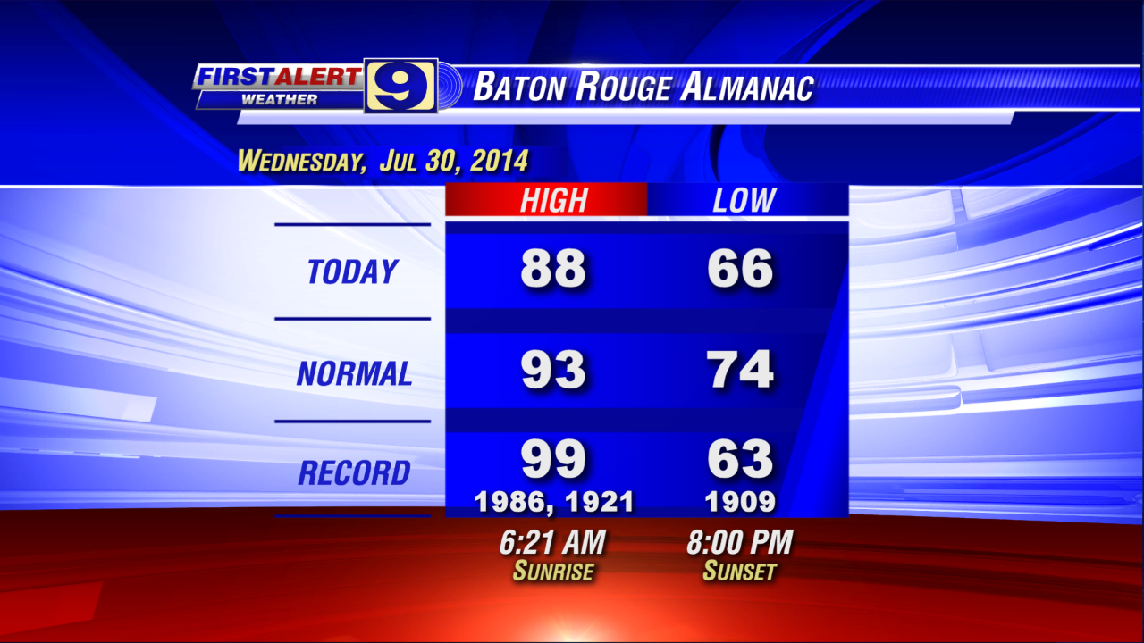
Wednesday, July 30, 2014

One More Comfortable Morning

By Jay Grymes & Steve Caparotta


WAFB First Alert Quickcast:

- another comfortable night and Thursday wake-up ahead
- humidity starts creeping back on Thursday with a slight chance of afternoon showers
- scattered-to-likely rains for Friday and the weekend
- still tracking a struggling 93L in the Atlantic

A fine morning indeed to start Wednesday and the afternoon followed suit. With highs in the upper 80°s to near 90°, sure … it was hot, especially in the direct sunshine. But if you spent much time outside today you certainly noticed the lower humidity. Even the mid-day heat seemed tolerable, making for a pretty nice summer day across the WAFB viewing area. Too bad more July and August days can’t be like today, eh?


But, alas, all good things come to an end. We’ll enjoy one more nice evening and overnight, with Red Stick wake-up temperatures on Thursday in the 60°s once again. But through the day, you’ll likely feel the humidity on a slow rise. It won’t get uncomfortably sticky on Thursday, just not as ‘dry’ of a feel to the air like we enjoyed today. And with just a touch more humidity and the stalled, meandering coastal front lingering in the region, we’ll add in a slight chance for some afternoon showers on Thursday -- say, around a 20% chance or so.

Then it’s back to Gulf Coast summer reality. We aren’t talking about all-day rains, but our forecast calls for a return to scattered-to-likely (mainly-afternoon) showers and storms for the viewing area on Friday, Saturday and Sunday. In addition to the wetter pattern into the weekend, Gulf humidity will be back to normal and daytime temps will run in the upper 80°s to low 90°s. Yes, a return of a more typical summer weather pattern for the region.


As for the tropics, what appeared destined to become a tropical cyclone (depression or tropical storm) yesterday continues having a tough time getting its act together -- not that we are complaining. ‘Invest 93L’ -- located roughly 1000 miles east of the Lesser Antilles -- continues to show a decent spin, especially for a system so close to the equator (storms typically need to be north of 10°N latitude to develop good rotation).

However, 93L is being held in-check by the entrainment (pulling-in) of dry air to its north. In effect, we have a system that shows ‘spin’ but can’t develop enough organized convection (thunderstorm activity) around its core to get an upgrade (TD or TS status). In fact, 93L is looking less developed today than yesterday. Still, the National Hurricane Center (NHC) keeps 93L with a 50% chance of development in the next two to five days.


So we’ve got a fair amount of uncertainty regarding the intensity forecast of 93L. The general ‘consensus’ of the computer models suggests that a slowly-organizing/intensifying 93L moves towards the Leeward Islands (the northern islands of the Lesser Antilles) over the next two to three days, then near or north of Puerto Rico and eventually towards the Bahamas by Day 5.