
 By Jay Grymes & Steve Caparotta
WAFB Storm Team QuickCast:
- hot, humid, summertime weather pattern through the week- slightly higher rain chances around mid-week
We started the day with a band of mostly light-to-moderate rainshowers to the north and west of the Capital City as well as a thundershowers along the coast. But for most WAFB commuters, it was a dry morning drive under mostly cloudy skies. In addition, much of the early-morning rains dissipated into the mid-to-late morning hours. At the same time, the lingering clouds kept temperatures from climbing into the 90°s for many communities and the day’s slower warm-up meant fewer showers and storms for the afternoon.
For the trivia buffs, today is the first day since June 15th with a high under 90° at Metro Airport (BTR).

However, a few showers and storms still managed to pop-up during the afternoon and a few of those storms were rather active in terms of lightning. At this time of year, if the air temps get up into the upper 80°s to near 90°, that is usually enough to fire-up at least a few storms even on a mostly-cloudy day. And as is usually the case, we look for most or all of the day’s rains to dissipate around sunset or soon after.
Frankly, there is nothing new ‘weatherwise’ in terms of our outlook through the coming week. Our daily forecast stays fairly steady right through the weekend:
- sunrise temperatures in the low to mid 70°s with some pockets of mainly-light fog possible,
- afternoon highs in the low 90°s for most WAFB communities, with Heat Index readings
peaking in the mid to upper 90°s, and
- isolated to scattered afternoon thundershowers each day (from 20% to 50% coverage).
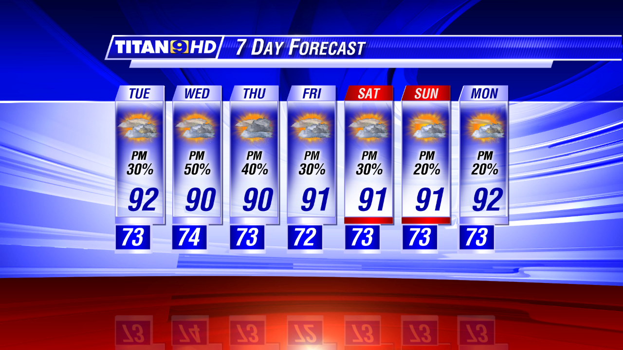
Rain chances may shift a little from day to day, but we’re not expecting any all-day rains this week. For Wednesday, we may nudge rain chances up to 50% or so, but the bottom line is a forecast that essentially reads, “More of the same.” But then, that’s how summer rolls in our neck of the woods.
All remains quiet in the tropical Atlantic … and there are no complaints in that department!
This is National Lightning Safety Awareness Week. Lightning is one of the most underrated weather threats, accounting for roughly 50 fatalities in the U.S. each year. For the Bayou State, there have been 17 lightning-related fatalities since 2000 and every one of them occurred to someone outdoors. Louisiana is certainly a hot spot for lightning strikes, ranking as the #2 state for hits (behind Florida). In fact, the number of cloud-to-ground strikes might surprise you: the statewide average is 20 strikes per square mile per year, but the annual average is actually a little higher for the southeastern portion of the state, including the WAFB viewing area!

No comments:
Post a Comment