
 By Jay Grymes & Steve Caparotta
WAFB Storm Team QuickCast:
- rain develops by Tuesday morning
- a few thunderstorms possible but no severe weather expected on Tuesday
- dry and cooler for the rest of the work week
Wet Weather for Tuesday
An upper-level low and associated surface low-pressure system currently located over south Texas and the western Gulf will track to the northeast tonight and tomorrow, delivering rains to the viewing area on Tuesday. The first of the rains are likely to arrive early in the morning -- we're calling for isolated-to-scattered rains arriving for the morning commute, so be ready for some slick streets along with patchy fog for the day's start.

The heaviest rains are expected closer to mid-day and into the early afternoon. While we do expect a few rumbles of thunder through the day, we are not concerned about a severe weather outbreak. Rain totals are expected to range from under one-half-inch for the northern portions of the viewing area to as much as one-inch or more closer to the coast -- so there are no serious flood threats, just the usual standing water in the usual places.
The rains should be winding down through the late afternoon and evening, with a few lingering light showers potentially extending late into the day. Highs on Tuesday should reach the upper 60°s to lower 70°s across the viewing area.
Cooler by Late Week
Tuesday's Gulf system will be followed by an advancing cold front from the northwest, with a Pacific air mass behind the front delivering another round of cooler air for the second half of the work week. The front slides through on Wednesday, bringing some clouds and possibly a light shower or two as it swings by -- but for most, Wednesday remains dry. Highs on Wednesday will top-out in the upper 60°s for most WAFB neighborhoods, with skies clearing through during the latter part of the day.

The clearing skies and cooler air mass set the stage for a return to the 30°s for many of WAFB northern communities by Thursday morning. Although there will be plenty of sunshine on Thursday, the Capital City may not even reach 60° for the afternoon high -- a reminder that we are still in the winter season.
Extended Outlook
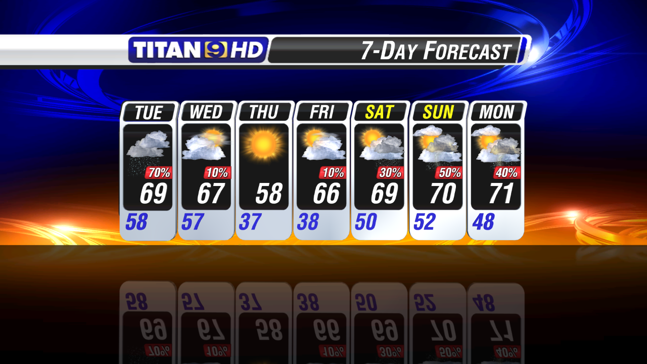
Many return to the 30°s for a second straight morning on Friday, with a warming trend underway by the afternoon and into the weekend. Unfortunately, chances of rain return to the area over the weekend along with some 70°s.
No comments:
Post a Comment